Sustainable Buildings Strategies:
The NIH is currently in the process of constructing a Geographic Information System (GIS) database that will be utilized to capture all sustainable building information and display it in an interactive real time format. This GIS database will allow all users to continually track and view how their buildings are performing, providing a vital tool to see whether or not the energy and water conservation and reduction strategies that have been implemented have worked. This tool will help bridge the gap between employees and data managers, allowing the actual users of the buildings view their direct impact to the environment.
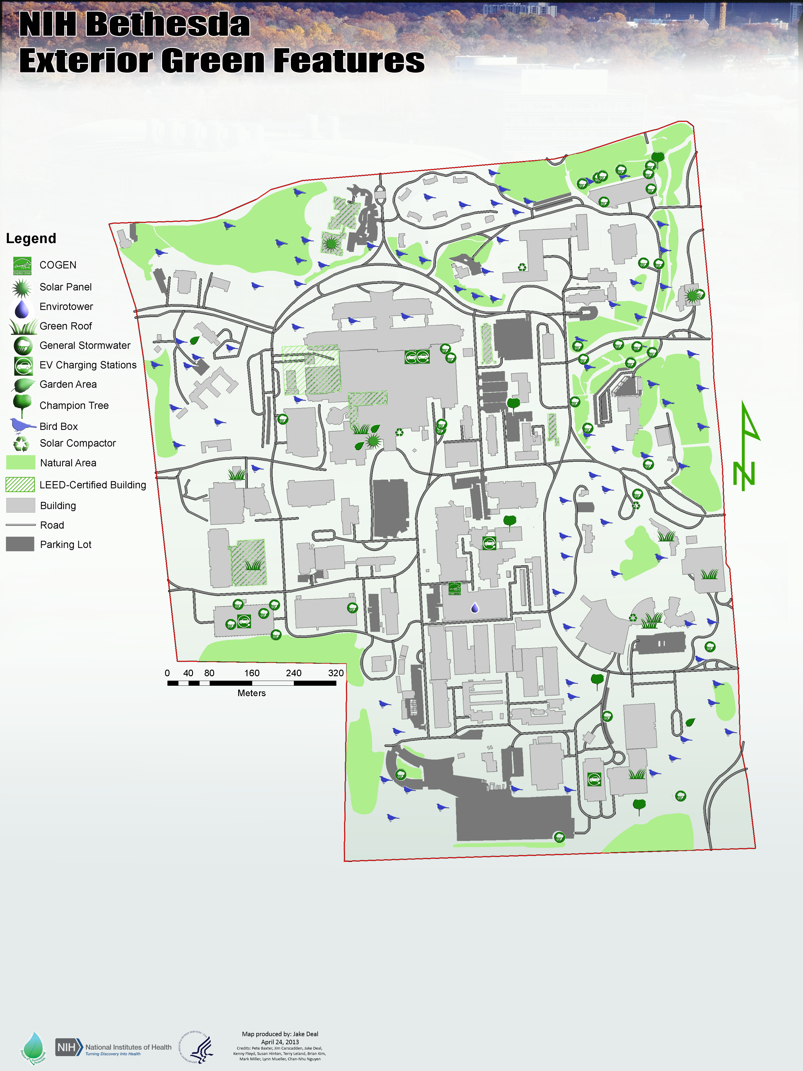
Fig. 1 NIH Bethesda Exterior Green Features Map